Event JSON
{
"id": "c9bb5d138d2d40424d6c43547d0eb75ea175dd2687b43fca711639eeb833ecb6",
"pubkey": "e586f9a0f67c2e505a9c39e6e683ca42ca68563065fb8b80ba0cdf1720bfce1c",
"created_at": 1759862255,
"kind": 1,
"tags": [
[
"t",
"openstreetmap"
],
[
"t",
"osm"
],
[
"t",
"mapping"
],
[
"imeta",
"url https://sudomakecake.com/system/media_attachments/files/115/334/271/037/558/112/original/c77860b49652a043.png",
"m image/png",
"dim 1440x2869",
"blurhash U7PaA..8HY-=$xDQR:DiN4R5R;Ro.lO?NItk"
],
[
"proxy",
"https://sudomakecake.com/users/woollypigs/statuses/115334332794651379",
"activitypub"
],
[
"client",
"Mostr",
"31990:6be38f8c63df7dbf84db7ec4a6e6fbbd8d19dca3b980efad18585c46f04b26f9:mostr",
"wss://relay.mostr.pub"
]
],
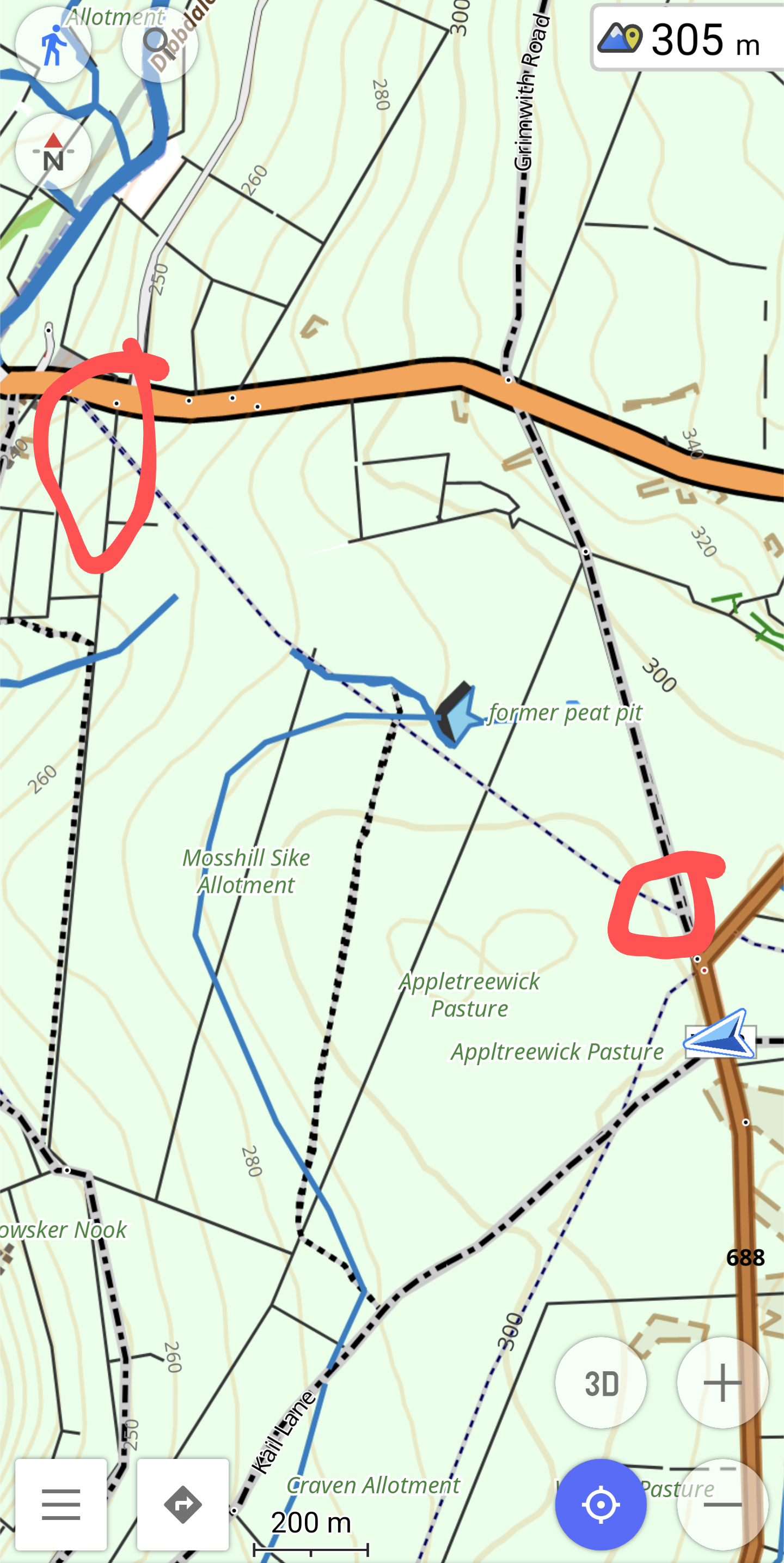
"content": "Mojn Mappers. I tried to use this path/trail the other day and I arrived at the top left / North West and were the path crossed two dry stone walls there were no signs of there ever had been a stile/gate. The ground didn't have any have any signs of there ever was a path here. Looped around and walked passed at the bottom right/ south east. Again the wall had no stile and the field beyond had no sign of there was any trail at all.\n\nhttps://www.openstreetmap.org/changeset/172972352#map=16/54.05950/-1.91334\n\nIs there a way to mark this trail as an old unused path, I see it was on an old map back in 1800-something.\n\n#OpenStreetMap #OSM #Mapping\n\nhttps://sudomakecake.com/system/media_attachments/files/115/334/271/037/558/112/original/c77860b49652a043.png",
"sig": "721ec037171485f21336f58400ae4805b4f5969d1d7b613b1974757e574675e8e1dbe6f4479528048fbd0965f39468b3a7d72fa0f25baf667ea9da27af655417"
}