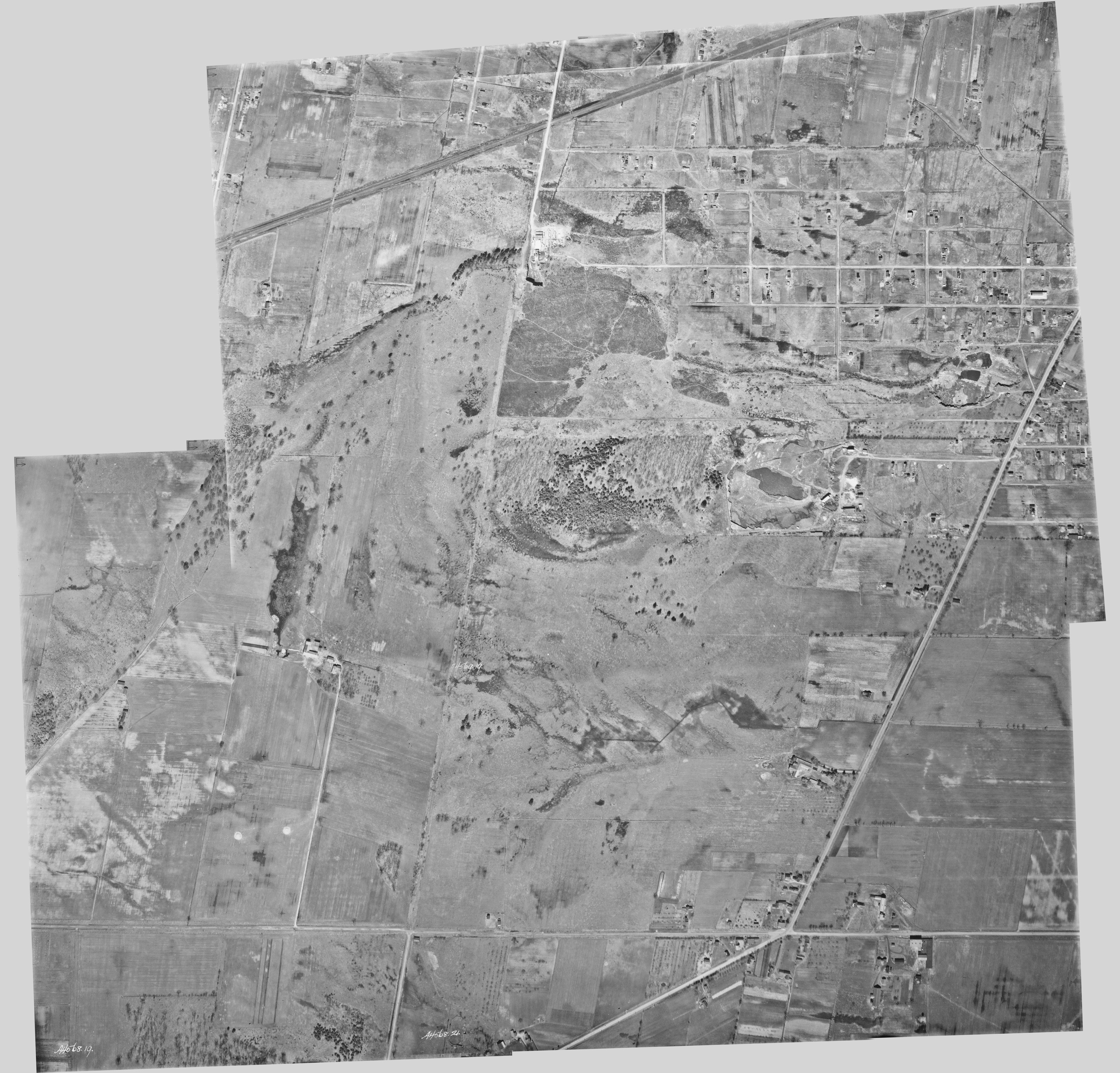
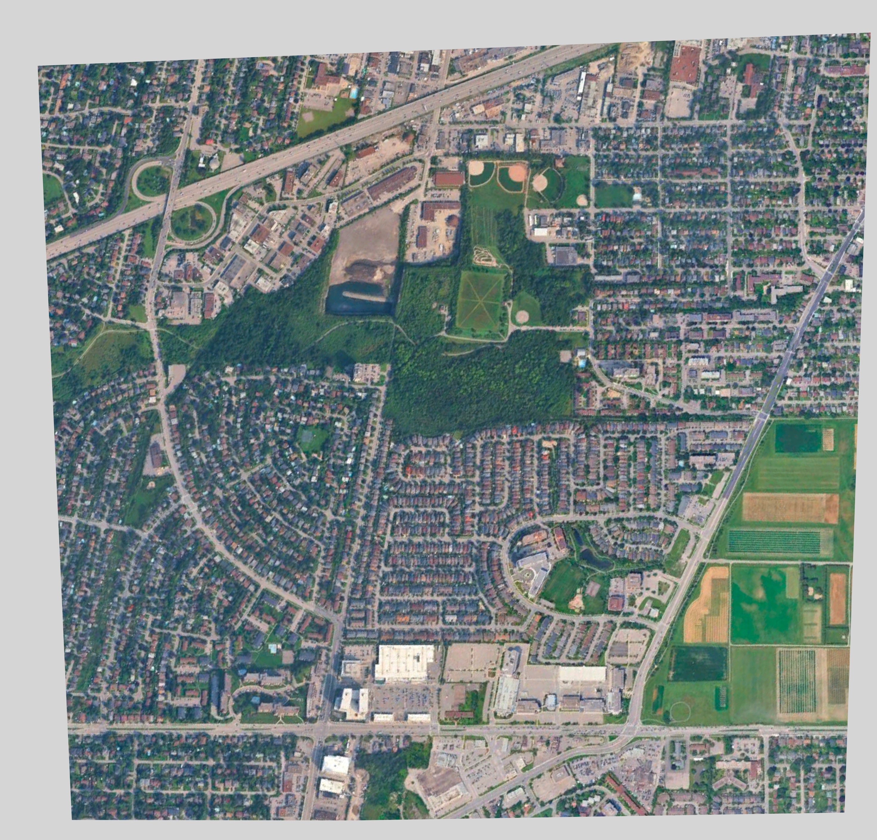
I managed to find some 1933 aerial pics of the area, and combined a few of them to compare with the modern layout of the area. I took a screenshot from Google Earth and distorted it a bit to match the aerial pics.
(https://ssimpkin.carto.com/viz/126c8e26-17a5-11e6-907b-0e5db1731f59/embed_map)
In 1933 the quarry was *just* getting started. There seems to be some kind of road/path that follows a straight line from Carling to Baseline. At the time, perhaps it was a slow, steady climb up the hill, but someone must have given up on the idea as the carve-out from the quarry straddles the old path, and now you have the aforementioned cliff.